GeoTools
Open-source Java GIS toolkit for geospatial formats, standards, and services.
LGPL-2.1-only
About
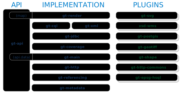
GeoTools is an open-source Java library for geospatial data access, processing, and service integration. It provides modules for vector and raster formats, coordinate reference systems, geometry, styling, and OGC services, and is used both as a standalone toolkit and as a foundation for GeoServer. The project is built with Apache Maven and supports Java applications across major operating systems. Individual modules can carry different license terms, so check the metadata for the artifacts you use.
Features
- Read and write common raster and vector formats
- Transform coordinates with CRS libraries
- Expose WMS, WFS, and other OGC services
- Provide geometry, topology, and styling APIs
- Support raster and vector processing pipelines
- Integrate with Java and Maven projects
Related tools

QGIS
Free and open-source cross-platform desktop GIS. Create, edit, visualize, analyze and publish geospatial data.

OpenLayers
High-performance, feature-packed library for creating interactive maps on the web.

MapLibre GL JS
Open-source TypeScript library for publishing maps on your website. Fast vector tile rendering.

Turf.js
Advanced geospatial analysis library for browsers and Node.js. Modular and fast.
Details
- Type
- Library
- Pricing
- open-source
- License
- LGPL-2.1-only
- API
- sdk
- Hosting
- Self-host