Category
Raster
Tools specialized in raster data formats and operations.
15 tools
15 tools found

GDAL
Translator library for raster and vector geospatial data formats. The Swiss Army knife of GIS.
gdal3.js
WebAssembly build of GDAL and OGR for geospatial processing in browsers and Node.js.

geotiff.js
Browser and Node.js library for parsing GeoTIFF files for visualization and analysis.
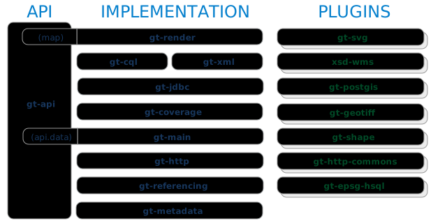
GeoTools
Open-source Java GIS toolkit for geospatial formats, standards, and services.

GeoWebCache
Java tile cache for accelerating WMS, WMTS, and other map tile services.

OpenLayers
High-performance, feature-packed library for creating interactive maps on the web.
Alternative to Google Maps Platform, Bing Maps

GRASS GIS
Free, open-source GIS software for geospatial data management, analysis, and visualization.
Alternative to ArcGIS
OpenDroneMap
Open-source CLI for turning aerial imagery into orthophotos, point clouds, DEMs, and 3D models.

Orfeo ToolBox
Open-source toolkit for large-scale optical, multispectral, and radar imagery processing.
PyWPS
Python implementation of the OGC Web Processing Service standard.

Rasterio
Python library for reading and writing geospatial raster datasets using GDAL.
Alternative to Google Earth Engine

rio-cogeo
Rasterio plugin for creating and validating Cloud-Optimized GeoTIFFs.

rio-tiler
Python library for generating map tiles and reading raster data from GDAL-supported sources.

TiTiler
Dynamic raster tile server for Cloud-Optimized GeoTIFFs and STAC items.

Xarray
N-dimensional labeled arrays in Python — the standard for netCDF and raster cubes.